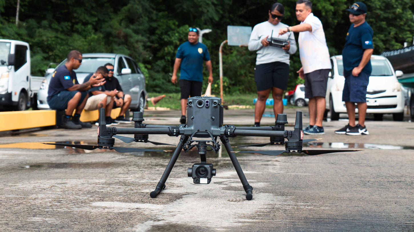
Drone training program for Maritime LEOs in Palau
Supply drones and train Maritime LEOs in Palau

Client
PICRC
Project Type
Education & Training
Location
Palau
Project Overview
In a significant step toward enhancing maritime security and surveillance capabilities, 2cofly conducted an intensive drone training program for nine maritime law enforcement officers in Palau. This initiative aimed to equip the officers with the necessary skills to operate advanced drone technology, thereby strengthening their ability to monitor and protect Palau's extensive maritime domain.
Training Objectives and Curriculum
The comprehensive training program was designed to provide both theoretical knowledge and practical skills essential for effective drone operations in maritime law enforcement contexts.
Key components of the curriculum included:
FAA Part 107 Certification Preparation: Ensuring that officers are well-versed in aviation regulations and standards, a crucial aspect for legal and safe drone operations.
Drone Safety, Regulations & Best Practices: Covering essential safety protocols, operational guidelines, and regulatory compliance to promote responsible drone usage.
Flight Operations & Hands-On Training: Providing practical experience in drone piloting, including maneuvering techniques, mission planning, and real-time problem-solving.
Data Acquisition & Analysis: Training officers in the collection and interpretation of aerial data, enabling them to utilize drone-gathered information effectively in their maritime surveillance and enforcement activities.
Outcomes and Impact
Upon completion of the training, the nine officers demonstrated proficiency in operating enterprise-level drones, positioning them to significantly enhance Palau's maritime law enforcement capabilities. The integration of drone technology is expected to improve the efficiency and effectiveness of maritime patrols, environmental monitoring, and enforcement of fishing regulations within Palau's territorial waters.
This training program underscores 2cofly's commitment to empowering local authorities through advanced technology and specialized education, contributing to the broader goal of maintaining security and sovereignty in the Pacific region.

2cofly (pronounced Ecofly) is Micronesia's leading drone service and education provider. Our core competency lies in remote sensing via various sensing technologies such as photogrammetry, LiDAR, thermal and more.
Few key deliverables we can output with our drones & sensors:
Orthomosaic Mapping (+ Planimetric Mapping)
Topographic Mapping (via LiDAR & photogrammetry)
General LiDAR Mapping (land feasibility study, power line, etc)
Aerial Inspection
Aerial Magnetometry (underground metal detection)
Thermal Map (radiometric)
We are also the largest drone training and education provider, offering:
Online Course
In-person workshops
Custom curriculums for students and professionals
Schedule a free consultation
(671) 988-1532 | dwl@2cofly.com

_gold-black.png)


